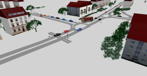
Satchell Lane, Vissim
A detailed VISSIM microsimulation model was created due to a refusal of planning permission for a proposed 61 residential units.

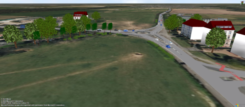
Land at Southwest Sittingbourne
You are here: Home » Case Studies »
A microsimulation VISSIM model was developed, calibrated, and validated for a development in Sittingbourne. The purpose of this model was to assess the effects of a proposed link road within the mixed-use development in the Southwest area of Sittingbourne. The dynamic assignment method was used to enhance the accuracy of the assessment. The model was able to simulate scenarios with and without the link road to quantify its effects and how it would impact traffic flow, congestion and accessibility as well as to model the impact of other mitigation. The use of VISSIM allowed very particular, complex and short-term operational characteristics of the network to be modelled, including the impact of school buses stopping and interacting with pedestrian crossings.
Despite reaching agreement with the relevant highway authority, the application was initially refused locally, including on highway grounds, and the assessment and model were subject to detailed scrutiny at planning appeal – ultimately resulting in an approval from the Secretary of State on the recommendation of the presiding Inspector.
PTV VISSIMA detailed VISSIM microsimulation model was created due to a refusal of planning permission for a proposed 61 residential units.
A bespoke microsimulation model using VISSIM microsimulation software was produced to incorporate two mini roundabouts as well as the effects of the associated existing signalised pedestrian crossings.
A microsimulation model was developed for the central Westwood Cross area of Thanet with the use of VISSIM software on behalf of Kent County Council.
Please get in touch using the form below.